Verified Laboratory MATLAB Implementation
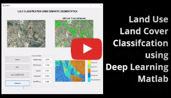
Land Use Land Cover Classifcation using Deep Learning Matlab
Discover how deep learning enhances land use and land cover classification in MATLAB. Learn AI-driven techniques for geospatial analysis, environmental monitoring, and urban planning.
MATLAB Laboratory Run Demonstration
100% Tested
Environment: MATLAB R2024b / R2026 Compatible
Deliverables: .m scripts, .slx models, .mat data
Validation: Verified simulation plots & GUI App
Documentation: Full IEEE formatted project report
Project Methodology & Algorithm Details
Abstract
As one of the important components of Earth observation technology, land use and land cover (LULC) image classification plays an essential role. It uses remote sensing techniques to classify specific categories of ground cover as a means of analyzing and understanding the natural attributes of the Earth’s surface and the state of land use. It provides important information for applications in environmental protection, urban planning, and land resource management. However, remote sensing images are usually high-dimensional data and have limited available labeled samples, so performing the LULC classification task faces great challenges. In recent years, due to the emergence of deep learning technology, remote sensing data processing methods based on deep learning have achieved remarkable results, bringing new possibilities for the research and development of LULC classification. In this paper, we present a systematic review of deep-learning-based LULC classification, mainly covering the following five aspects:
(1) introduction of the main components of five typical deep learning networks, how they work, and their unique benefits;
(2) summary of two baseline datasets for LULC classification (pixel-level, patch-level) and performance metrics for evaluating different models (OA, AA, F1, and MIOU);
(3) review of deep learning strategies in LULC classification studies, including convolutional neural networks (CNNs), autoencoders (AEs), generative adversarial networks (GANs), and recurrent neural networks (RNNs);
(4) challenges faced by LULC classification and processing schemes under limited training samples;
(5) outlooks on the future development of deep-learning-based LULC classification.
Introduction
Land use and land cover (LULC) is the expression of the transformation of the natural ecosystem of land into an artificial ecosystem and the naturally occurring or human-induced cover on the surface. It serves an important role in the fields of disaster management, urban planning, environmental protection, and agricultural production, and has been a popular theme in Earth observation research. Remote sensing images have become the main data source for LULC classification due to their advantages, such as wide coverage and continuous monitoring to obtain time series data. Since the introduction of deep learning, excellent results have been achieved in the field of image processing, and thus, LULC classification has become a popular research topic.
The initial classification technique was visual interpretation classification, which was judged by the expertise of the interpreter. The advantage is that the accuracy is high, generally higher than the computer classification accuracy, so the visual interpretation classification is still applied to high-precision, high-resolution remote sensing image classification. However, the biggest disadvantage is poor repeatability and poor timeliness. With the development of computer technology, machine learning is widely used in LULC classification. Traditional classification techniques are divided into two types: unsupervised and supervised classification. Unsupervised classification is represented by K-Means and Expectation Maximization, which can distinguish the categories for data processing; however, the attributes of the classification results are uncertain. Common supervised classification algorithms include support vector machine (SVM), decision tree, maximum likelihood classification, and so on. The parameters of the discriminant function are derived from the known image element data, and then the discriminant function is used to classify the unknown image elements. Traditional classification techniques are characterized by good repeatability and timeliness compared to visual interpretation; however, the accuracy of the classification will be greatly reduced after changing the data or study area.
In contrast to classic machine learning algorithms, deep learning (DL) demonstrates unique advantages in image classification. While traditional machine learning algorithms require the manual design of features for classification tasks, deep learning eliminates the need for manual intervention; it automatically learns and extracts features relevant to the target task, and this automatic feature extraction capability endows deep learning models with strong robustness and makes it easier to migrate the models across different datasets. Deep learning algorithms can learn from large-scale data and discover potential patterns and regularities, thus improving the accuracy and effectiveness of LULC classification.
Need the Complete Source Code & Report for This Project?
Get fully documented code, dataset, and step-by-step guidance before your academic deadline.
15-Min Response
Customize This Project
Direct review by PhD Lead Engineer
Related Project Demos
Need Custom Engineering Code?
Our PhD engineers provide complete MATLAB/Simulink projects with verified test cases and IEEE reports.
Order Project Solution →